Skip to main content
Skip to "About this site"
Canada.ca
Services
Departments
Language selection
Français
Search and menus
Search and menus
Natural Resources Canada
Search
Search website
Search
Topics menu
Our Natural Resources
Climate Change
Energy Efficiency
Maps, Tools and Publications
Public Consultations
Science and Data
You are here:
Home
Forests
Forest Topics
Fire
CWFIS
Background Information
Background Maps
Background Maps
Map Types
Elevation
Ecozones
Weather Stations
FBP Fuel Types
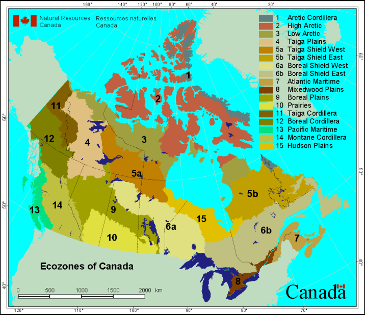
Ecozones
Section menu
CWFIS
Background Information
Maps and Reports
Interactive map
Current Conditions
Fire Danger
Weather
Fire Weather
Fire Behavior
Fire M3 Hotspots
Monthly and Seasonal Forecasts
National Wildland Fire Situation Report
Historical Analysis
Fire Weather Normals
Fire Behavior Normals
Canadian National Fire Database (CNFDB)
CWFIS Datamart
Publications