Weather Maps
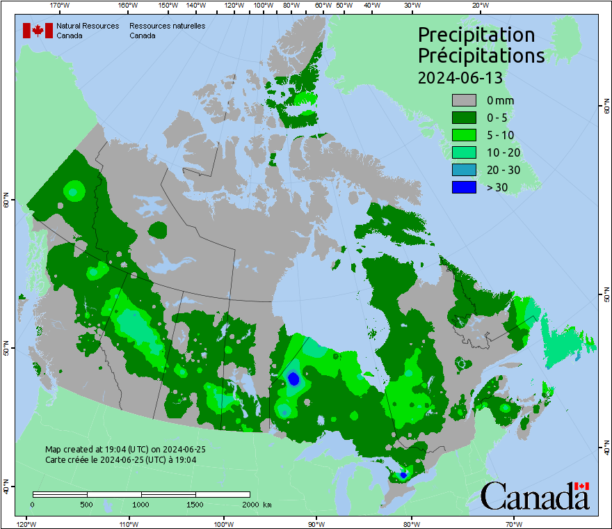
This map displays 24-hour accumulated precipitation at local noon. Because Canada covers several time zones, local noon occurs at different times in different parts of the country. Precipitation values are interpolated between weather stations. Precipitation amounts can vary significantly over short distances; therefore, this map is accurate only at weather station locations and gives a general indication of precipitation conditions elsewhere.
Daily weather observations are required for the Canadian Forest Fire Weather Index (FWI) System calculations. More information about weather processing and the FWI system is available in the Background Information.
Forecasted weather data provided by Environment Canada. More information about forecasted weather is available in the Background Information.
Maps are updated daily, at 6 p.m. Mountain Standard Time.