CWFIS Datamart
Metadata

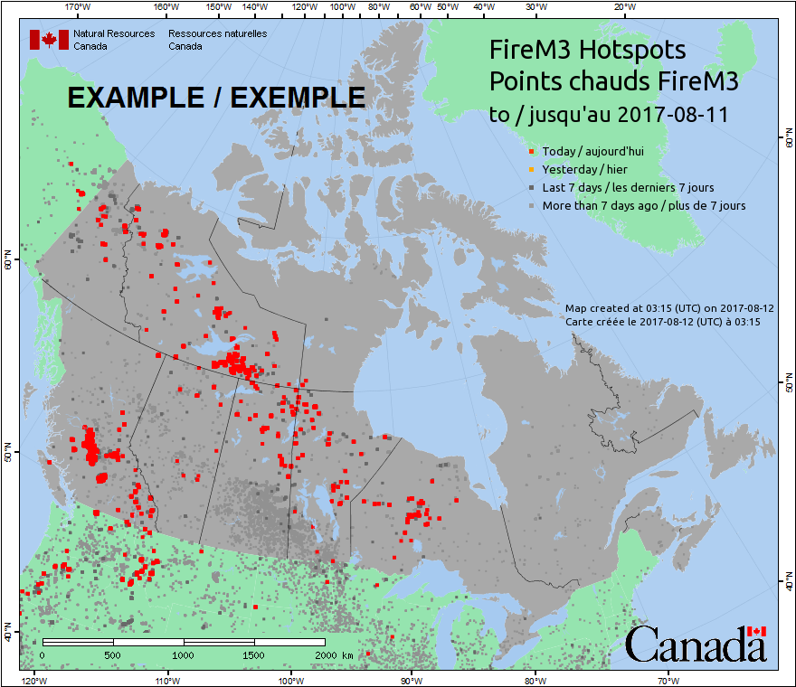
Fire M3 Hotspots
Description
A hotspot is a satellite image pixel with high infrared intensity, indicating a heat source. Hotspots from known industrial sources are removed; the remaining hotspots represent vegetation fires, which can be in forest, grass, cropland, or logging debris. A hotspot may represent one fire or be one of several hotspots representing a larger fire. Not all fires can be identified from satellite imagery, either because the fires are too small or because cloud cover obscures the satellite's view of the ground.
The Fire M3 hotspots are obtained from multiple sources:
1. Advanced Very High Resolution Radiometer (AVHRR) imagery, courtesy of the U.S. National Oceanic and Atmospheric Administration (NOAA) National Environmental Satellite, Data and Information Service (NESDIS).
2. Moderate Resolution Imaging Spectroradiometer (MODIS) imagery, courtesy of the National Aeronautics and Space Administration (NASA) Land, Atmosphere Near real-time Capability for EOS (LANCE) Fire Information for Resource Management System (FIRMS), and from the Active Fire Mapping Program, Remote Sensing Applications Center (RSAC), USDA Forest Service. (https://fsapps.nwcg.gov/afm/)
3. Visible Infrared Imaging Radiometer Suite (VIIRS) imagery, courtesy of NASA LANCE FIRMS, University of Maryland and RSAC.
Fire M3 maps and reports are updated daily from May through September.
More information about Fire M3 is available at: http://cwfis.cfs.nrcan.gc.ca/background/dsm/fm3
Supplemental Information
The Fire Monitoring, Mapping, and Modeling System (Fire M3) began operations in 1998 as an initiative of the Canada Centre for Remote Sensing and the Canadian Forest Service, both agencies of Natural Resources Canada.The goals of Fire M3 are to use low-resolution satellite imagery to identify and locate actively burning fires on a daily basis; to estimate daily and annual area burned; and to model fire behavior and biomass consumption from fires.
Hotspot locations and attributes are obtained from the US National Oceanic and Atmospheric Administration (NOAA), the US National Atmospheric and Space Administration (NASA), the US Forest Service, and the University of Maryland. Hotspots are identified from infrared satellite imagery acquired by the Advanced Very High Resolution Radiometer (AVHRR), Moderate Resolution Imaging Spectroradiometer (MODIS) and the Visible Infrared Imaging Radiometer Suite (VIIRS).
Subsequent processing of hotspot data involves combining the datasets from multiple sources, estimating fire weather conditions and fire behavior potential at hotspot locations using the Canadian Forest Fire Danger Rating System, and mapping burned area. In addition to images and reports for the web, data is made available to partners in fire management and industry, and it is used as input to other models such as smoke forecasting.
More information about Fire M3 is available at: http://cwfis.cfs.nrcan.gc.ca/background/dsm/fm3
Licenses
Open Government Licence - Canada (http://open.canada.ca/en/open-government-licence-canada)
When the Data is displayed, in print, electronically, or otherwise, the source (i.e., Natural Resources Canada) must be acknowledged along with the following citation: Canadian Forest Service. 2022. Canadian Wildland Fire Information System (CWFIS), Natural Resources Canada, Canadian Forest Service, Northern Forestry Centre, Edmonton, Alberta. http://cwfis.cfs.nrcan.gc.ca.
Data Resources
Daily Hotspots (CSV)
For additional information, please see the metadata included with the data itself.