Weather Maps
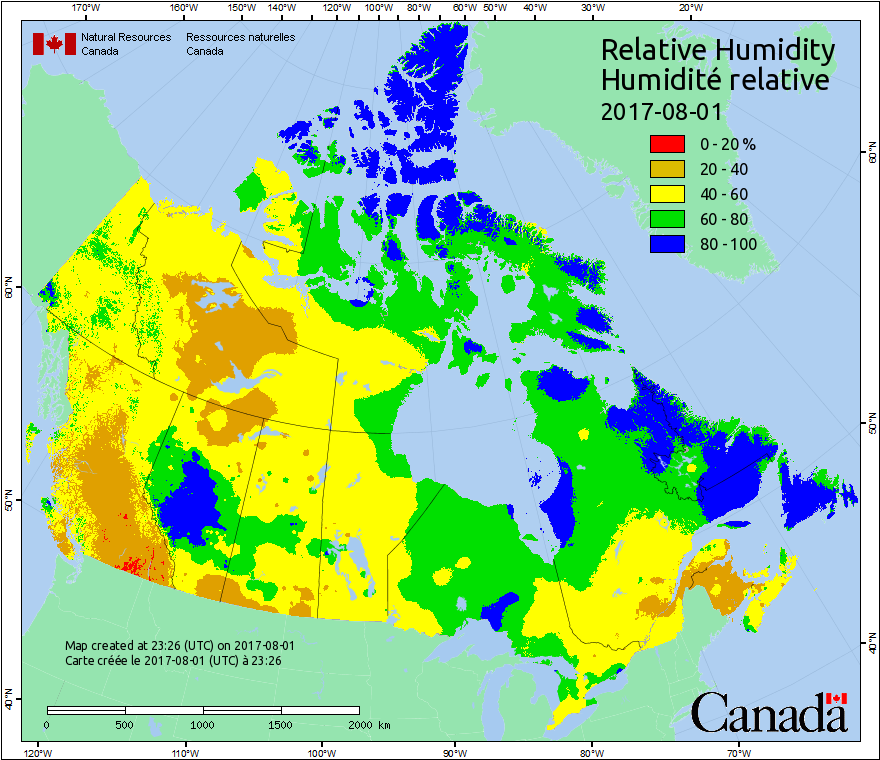
This map displays conditions at local noon. Because Canada covers several time zones, local noon occurs at different times in different parts of the country. Relative humidity (RH) values are determined by interpolating the mixing ratio (the ratio of water vapour to dry air) between weather stations, then calculating the RH at each grid cell using temperature and pressure grids.
Daily weather observations are required for the Canadian Forest Fire Weather Index (FWI) System calculations. More information about weather processing and the FWI system is available in the Background Information.
Forecasted weather data provided by Environment Canada. More information about forecasted weather is available in the Background Information.
Maps are updated daily, at 6 p.m. Mountain Standard Time.