Background Information
Fire Monitoring, Mapping, and Modeling (Fire M3)
Summary

Wildfires represent a significant agent of change in Canadian forest ecosystems. Approximately 9000 fires burn 3 million ha per year in Canada (based on a 10-year average). While only 2% to 3% of these wildfires grow larger than 200 ha, they account for almost 97% of the annual area burned. Thus, they provide an excellent opportunity to monitor active fires with a combination of low- and high-resolution sensors for the purpose of determining fire location, area burned, fire behavior, and fire severity. Given Canada's size, the use of remote sensing data is a cost-effective way to achieve a comprehensive overview of forest fire activity in near-real time.
The Fire Monitoring, Mapping, and Modeling System (Fire M3) began operations in 1998 as an initiative of the Canada Centre for Remote Sensing and the Canadian Forest Service, both agencies of Natural Resources Canada.
The goals of Fire M3 are to use low-resolution satellite imagery to identify and locate actively burning fires on a daily basis; to estimate daily and annual area burned; and to model fire behavior and biomass consumption from fires.

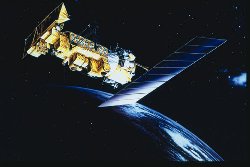
Hotspot locations and attributes are obtained from the US National Oceanic and Atmospheric Administration (NOAA), the US National Atmospheric and Space Administration (NASA), the US Forest Service, and the University of Maryland. Hotspots are identified from infrared satellite imagery acquired by the Advanced Very High Resolution Radiometer (AVHRR), Moderate Resolution Imaging Spectroradiometer (MODIS) and the Visible Infrared Imaging Radiometer Suite (VIIRS).
Subsequent processing of hotspot data involves combining the datasets from multiple sources, estimating fire weather conditions and fire behavior potential at hotspot locations using the Canadian Forest Fire Danger Rating System, and mapping burned area. In addition to images and reports for the web, data is made available to partners in fire management and industry, and it is used as input to other models such as smoke forecasting.